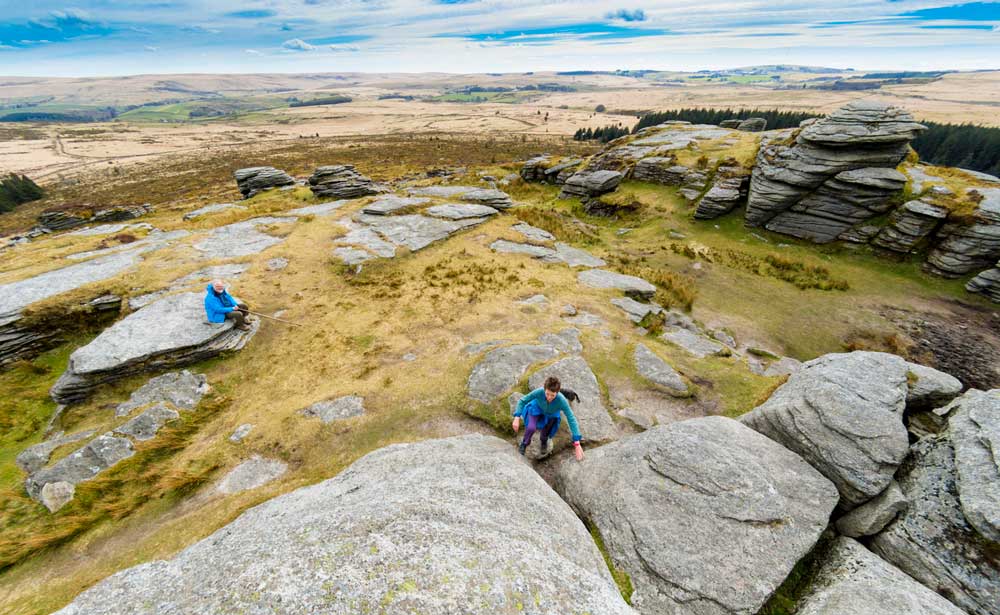
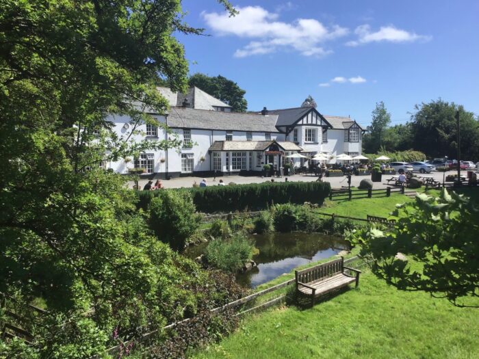
Scorhill and Teignhead walk
Batworthy Corner, Chagford
About this walk
Thanks to Simon Dell of Moorland Guides for this walk.
Some stiles and open moorland to cross. In poor visibility, especially on the Teignhead section of this walk a map and compass is essential. All river crossings are over bridges.
Park at Batworthy Corner by the bridge to Batworthy Farm taking care not to obstruct the turning circle for the local school bus. Alternative parking is sometimes available further back the road towards round pound at SX663 867 when the boulders blocking the seasonal car park are removed and the ground is hard. Leave nothing of value in your vehicle to tempt any opportunist thieves.
Walk back along the lane you have just come along for about 400 metres with views to your right of Kes Tor Rock and over the valley to your left to Scorhill Down which you will be walking over a little later on your walk. Continue to Round Pound at SX 664 868 on your left.
Round Pound is so impressively built that even the local road has been built in a curve around the outside. It consists of a large internal hut circle about 12metres in diameter with an oval shaped pound around the outside. The walls of this structure are huge, up to 4 metres in width and 2 metres in height, with an entrance made using large slabs. Inside the pound are the remains of several walls connecting between the central hut and the outer wall.
Once you leave Round Pound continue north-east along the lane over the cattle grid and downhill along the wooded lane passing Brimstonedown on your left to the sharp right hand bend in the lane. At the bend you leave the tarmac lane and turn left into a footpath and over a stile. The footpath is part of the Two Moors Way with the distinctive MW sign on the finger-post indicating the way to Gidleigh and the Mariner’s Way, another long distance path Mariners’ Way is an ancient trackway supposed to have taken its name from the sailors who founded it. After signing off a boat in Dartmouth, they would trek across the peninsula to sign on with another boat at Bideford.
The path takes you down hill into the woods and continues downhill left at another signpost to the North Teign River, which you cross by way of a wooden footbridge SX671 875. Once over the bridge you enter an oak wood where many of the trees have ferns growing out of their boughs. Once you have left the bridge continue to the large footpath ahead and turn right with Holly trees and Rhododendrons lining the way.
At the next signpost you turn left up into the trees, signposted ‘Mariner’s Way’.
As soon as you enter the trees the path takes you up and slightly to the right past a large moss covered rock. The path becomes more distinct as you pass Gidleigh Tor hidden amongst the trees up on your left. The path takes you steeply up and out into less dense woodland, in season bluebells carpet the area. The path takes you through the woods to an open clearing and vehicle turning area where the footpath sign indicates your way to a lane under some large Beech trees. The lane follows the woods on your left and open farmland on your right until you reach a gateway leading out onto a tarmac lane.
The gate is locked but there is a stile here and as you climb it you will see, ahead of you over the fields, the tower of Gidleigh Church. Turn right down the lane towards Gidleigh. On your right there is a gateway into a field, one of the gateposts is a good example of the old five bar gateways with an upside down ‘L’ socketed granite post to take the bars from the opposite gatepost prior to the introduction of the modern fivebar gates. Continue down the hill to Gidleigh Cross junction where there is a welcome seat by the grassy triangle at SX672 883.
Turn left here, signposted to Gidleigh Chapel, and continue along the lane to Gidleigh Church where there are some nice 18th Century gravestones leaning on the wall and inside there Church there is a fine example of a 16th Century Chancel Screen. The churchyard is one of the few in Britain which has a stream running through it with a small bridge leading to a convenient seat, which has fine views of the nearby Gidleigh Castle ruins, on private land next to the Church.
The Manor of Gidleigh was owned by the Prouz family from the 13th Century until the 16th Century and it was William de Prouz who built the fortified Manor House, now known as Gidleigh Castle, in about 1324.
After the Church continue along the lane to a ‘T’ junction where you turn left signposted to Scorhill and Creaber. Continue up the steep hill passing a house on the right. You then come across two gates on the left, the higher of which also has the old style five bar slots, and at the top of the hill at the right hand bend there is another gateway on the left with similar slotted posts. This gateway affords panoramic views across the valley to Kestor Rock.
At the next ‘T’ Junction at the grassy triangle turn left signposted to Creaber and Scorhill, passing Greenaway Farm on your left, continuing up the hill and ignoring the left junction to Creaber, but instead continuing up the hill in the Scorhill direction. At the sharp left bend in front of Cherryford House turn right to Scorhill and carry on up the hill under the trees to the end of the lane at he vehicle turning area and the gateway that leads out onto Scorhill Down and the open moors at SX660 877.
Go through the gate and along the footpath through the gorse bushes. The path leads you to the left side of the drift lane and to the left wall corner as you go out onto the moors. Continue up the hill and along the grassy bridle path aiming for the top of the hill ahead of you. The well defined path continues over the hill with views to the right of Cosdon Beacon, the wall drops away to the left but we carry on up the hill over the down. The hills to our right include the distinctive Hound Tor and to our left the closest hill is Meldon Hill above Chagford. Behind you are fine views away to east Devon. Continue to the top of the hill, with views to your left of Kestor Rock and the trees where you parked your car a couple of hours ago. At the top of the hill you can see Fernworthy Forest ahead of you and to the right of the forest is the small group of trees at Teignhead Farm. Nearer is the narrow fir plantation leading down into the valley of the North Teign River, the trees leading right down to the location of the Tolmen Stone which is on our route shortly. Carry on down the other side of the hill along the wide grassy path until you reach a small bridge over a leat. At this point a small detour to our right, along the path will take us to Scorhill stone circle at SX654 873. This stone circle is one of Dartmoor’s finest: only thirty four stones remain of an original sixty five to seventy, and only twenty five of those are still standing. Two cart tracks run right through the ring, making its appearance even more impressive. The tallest of the stones is over 8 feet high.
One of the stones, lying down, has some signs of an attempt to split it using the ‘feather and tare’ method.
After visiting the stone circle retrace your steps back to the leat and small bridge and continue downhill until you reach the North Teign River at the end of the narrow fir plantation leading down from the other side of the river. At a point opposite the end of the plantation is found the Tolmen Stone.
The Tolmen Stone is a massive boulder lying on the bed of The River Teign. It has a hole through it, eroded by the force of the river. It is reputed that any adult who passed through the hole would be cured of rheumatism. If a child with Whooping Cough passed through the stone a cure would also be found.
After viewing the stone walk upstream and using the two bridges cross the Wallabrook and the North Teign river. Once crossed a small detour downstream again will lead you to the ancient Teign-e-ver Clapper Bridge, bonded together with iron straps.
Now continue over the hill walking parallel with the edge of the forest on your left using one of the well-defined paths. At the end of the plantation turn left and only a few hundred yards will bring you to Batworthy Corner and your vehicle.
For those who wish to continue with the walk, on the blue 5-mile route, to Teignhead Farm, at the end of the plantation instead of turning left back to Batworthy simply continue up the hill in the dip between the sloped on your left and right. This will lead you up to the impressive double stone rows on the hillside. Once you have reached the point where a second stone row joins the main row your turn westwards and across the open Shovel Down to take a look at the extensive ruins of the mediaeval settlement remains.
After leaving the settlements continue south westerly to the wall leading down from Fernworthy Forest and cross it at one of the numerous gates or stiles, and carry on to the end of the forest on your left where you can see the small copse of trees at Teignhead Farm. You come to a second wall leading from the forest on the left, and there is a gate and stile to use in crossing it. After going through the wall turn down to the right instead of carrying on to the large Teignhead Clapper Bridge but go down the slope to the small clapper foot bridge over the steam. As you stand at the clapper there is a small boulder only a few yards away from the bridge that has a cross inscribed on it and a few worn words. This is a memorial to the Dartmoor author, Harry Starkey. After crossing the Manga clapper bridge carry on up the slope using the well-worn footpath up to the gateway in the wall on your right. This leads to the lane taking you to the ruinous Manga Farm, well worth a visit.
Once seen you ca then continue to Teignhead Farm further to the southwest.Teignhead Farm was established in 1780 and was occupied until 1943 when the War Office (now the Ministry of Defence) requisitioned the land. There are two find examples of the slotted five bar gateposts at this farm.
The route from the farm is an easy track back north east to the magnificent Teignhead Clapper Bridge and your way takes you back diagonally across the slope to go through the wall that you crossed earlier leading from the forest down to Manga Clapper Bridge. Once through the wall carry on with the forest on your right side along the wide well defined bridle path running parallel with the forest but a hundred yards from it. This path is clearly leading you up to Kestor Rock. Once you pass the end of the forest carry on up the hill and at the top of the hill you hill come across a cross roads in the path where the double stone comes up from your left and crosses your way. The stones on the left are small and indistinct but on your right you’ll notice four of them in the path leading to your right. It is worth a brief detour to turn right here to visit to lovely standing stone known the Three Boys with its parish boundary marks of the Gidleigh Parish (GP) and the Duchy of Cornwall (DC) lands.
Once you have visited the Tree Boys stone you carry on up to Kestor Rock where on the summit you will find an example of one of the finest Rock Basins (or Pans) on Dartmoor. After Kestor Rock the route back to Batworthy Corner and your vehicle is down a well-worn path over the grassy slopes.
Distance
Two 5-mile walks or one 10-mile walk
Start point
Car park at Batworthy Corner SX662 865.
Basic route
(Blue route) Into the valley of the North Teign River to Gidleigh then to Scorhill Down and the Tolmen Stone and back to Batworthy Corner. (Red route) Over Shovel Down to Manga Farm and Teignhead Farm ruins and return via Kestor Rock to Batworthy Corner.


