In 2022 the Abbot’s Way Walk, which is organised and run by Tavistock & District Outdoor Education Forum with the help of volunteers, turned 60. It is a long-distance day walk between Buckfast and Tavistock Abbeys through the southern part of Dartmoor. The actual route, however, is debatable because the annual challenge follows part of the Way as marked on Ordnance Survey maps, crossing the Avon, Erme and Plym Rivers, which can all swell rapidly after heavy rain. Eric Hemery (1983), on the other hand, says that the ancient crosses between Horn’s Cross (Holne Ridge) and Nun’s (Siward’s) Cross denote the more plausible route, staying on the northern part of the South Moor and avoiding any precarious river crossings. The author also goes on to say that the Way would have passed through Walkhampton and that following the T/A guide stones towards Merrivale from Princetown would have made little sense from a geographical or topographical point of view.
This walk is a pretty big event and attracted over 400 people (or 78 teams) in 2022. This was my first attempt at the Way so I was keen to see what it had to offer. I was accompanied by Amanda Ellis and Fiona Rothwell; our team name was ‘Mafiam’.
We arrived at Buckfast Abbey early, submitting the all-important legal information and signing in to promptly leave just after 7am. We walked west up the lane to Cross Furzes, passing a couple of crossroads (Fritz’s Grave and Hockmoor Head) early on. The rain was lashing down on us, it was unpleasant, and really I wanted to be back home in bed! But when we were told we were the second team through the first checkpoint, that was a massive morale boost.
Over Dean Burn Clapper and onto the moor at Water Oak Corner, we dropped down to Brockhill Ford, catching sight of Avon Dam Reservoir. The rain had stopped and a glimmer of light illuminated the Avon valley. The weather was about to improve far earlier than forecasted. We sailed through Huntingdon Cross and the clapper over the Avon facing the gruelling climb up to Crossways.
The view up the Erme was inviting, but in truth there were a number of tricky river crossings that we would soon have to negotiate; Red Lake, Dry (Hux) Lake, Wollake (Blacklane Brook) and the Erme. There are a few ways through Erme Pits which is a series of tinners’ gerts and spoil tips. We got onto the high ridge, turning back to see the trail of people behind us. Broad Rock sits on the col between Langcombe Hill and Great Gnats’ Head. It is a solitary slab that is significant as being the northernmost part of the Blachford Estate, and on the stone can be seen ‘BB’ (Blachford Bounds). The Estate is close to Cornwood.
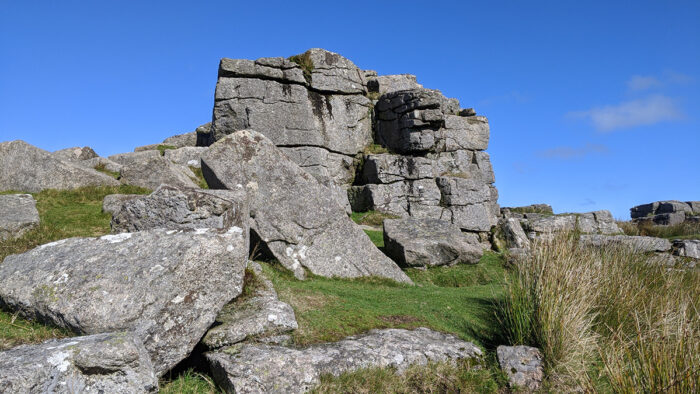
We rounded the hill to Plym Ford and struck over Hand Hill to Nun’s Cross. This is perhaps the best-known cross on the moor: it is accessible and highly recognisable. On one face you might be able to discern the text ‘BOC LOND’ for Buckland (Abbey). In order to reach South Hessary Tor we were forced onto the paved track that loves to pound the feet! En route a friend, Bev, joined us, and the day was becoming very much like summer! We spent no time in Princetown focussed on reaching the high point for the day – North Hessary Tor. This fine tor affords some of Dartmoor’s best views (if you can ignore the transmitter). We agreed to take lunch on nearby Hollow Tor, which is a better rock formation.
Psychologically, the remainder of the route was all downhill. We book a visual beeline to Four Winds car park, once Foggintor School, which is now a grove of trees. Nearby Merrivale Antiquities were passed as we descended to Merrivale Bridge, leaving Bev and thanking her for her company. Following the road we branched left towards Beckamoor Ford and Windy Post Cross. A rapid descent ensued taking us into Moortown, and the road ahead was pretty monotonous, rising slightly onto Whitchurch Down. This is a large area of flat moorland which is the location of Tavistock Golf Club.
I made a minor diversion to Whitchurch Down Cross before rejoining the team in the final leg down into Tavistock to the college. We received our certificates and refreshments; both were very much appreciated. It was a grand walk and the weather, for the most part, could not have been better. I wish to thank my team, the organisers and everyone else involved for making the 60th anniversary one to remember.
Max Piper
Blog: www.torbagger.co.uk
Max is the author of the book ‘East Dartmoor’s Lesser-Known Tors and Rocks’. It is a celebration of all of the tors on East Dartmoor that go unmarked on Ordnance Survey maps, those that many people will simply not be aware of because so many are buried beneath a canopy of trees. The book acknowledges the incredible works of writers, locals and enthusiasts alike, containing over 350 pages and 240 photos. It can be ordered directly from the author himself HERE.
South Hessary tor
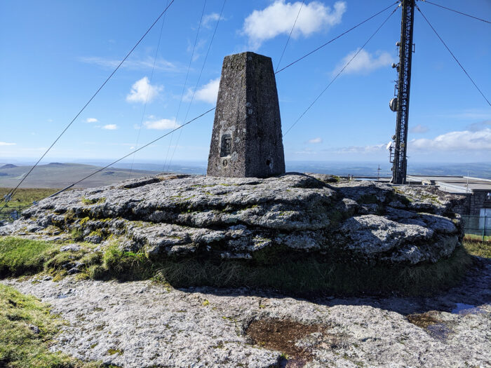
North Hessary tor
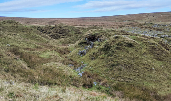
Erme Pits
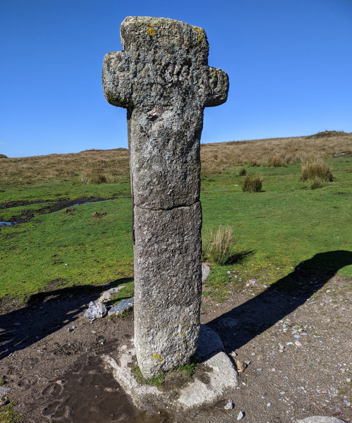
Nuns Cross
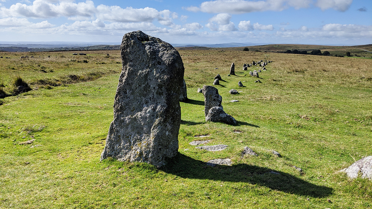
Merrivale a stone row
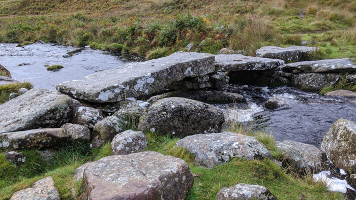
Huntingdon Warren clapper bridge
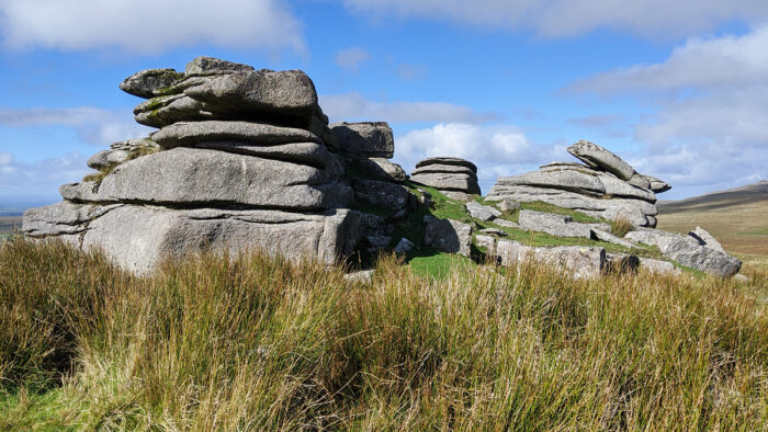
Hollow tor Rundlestone


