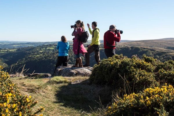
Dartmoor. Just the name stirs something — wild, ancient, unpredictable. Stretching across 368 square miles of southwest England, this national park draws over 2.4 million visitors each year. But not all of them come prepared.
Know What You’re Walking Into
Dartmoor isn’t a manicured trail park. It’s open moorland with boggy ground, sudden weather shifts, and limited mobile signal across vast stretches. The terrain can look deceptively gentle from a distance — and that’s exactly where it tricks people.
The National Park Authority records dozens of search-and-rescue callouts annually. In 2022 alone, Dartmoor Rescue Group responded to over 120 incidents. Many involved walkers who simply underestimated the conditions.
Check the Weather — Every Single Time
Dartmoor creates its own microclimate. Cloud can roll in within minutes, dropping visibility to near zero. Temperatures can fall 5–10°C compared to nearby towns like Exeter or Plymouth.
Always check a dedicated mountain weather forecast, not just a standard app. The Met Office Mountain Forecast covers Dartmoor specifically. Check it the morning of your walk, not the night before.
Dress for Survival, Not Style
Waterproof gear isn’t optional here — it’s fundamental. A quality waterproof jacket and trousers, layered base clothing, and sturdy ankle-supporting boots are the baseline kit. Cotton kills in wet cold environments; stick to wool or synthetic fabrics.
Pack more than you think you need. Emergency supplies should include a foil survival blanket, a whistle, a torch with spare batteries, and enough food and water for an extra two hours beyond your planned route.
Navigation: Old-School Skills Still Matter
Mobile signals on Dartmoor are patchy at best. GPS apps drain batteries and fail in the cold. Knowing how to use a 1:25,000 OS map and compass is not old-fashioned — it’s essential wilderness navigation for UK conditions.
Download offline maps before you go. Mark your start point, intended route, and nearest emergency access road. The ability to read contour lines could genuinely save your life on the moor.
Tell Someone Your Plan
This is non-negotiable. Before any solo or group walk, notify an emergency contact with your full route, estimated return time, and what to do if they don’t hear from you by a set hour. Write it down — don’t rely on a quick verbal mention.
Include the grid reference of your start point and the nearest car park. If mountain rescue is called, this information slashes response time dramatically.
Stay Secure Online Before You Head Out
Planning a Dartmoor trip often involves research — weather forecasts, route guides, local accommodation. Some travellers use VPNs while researching or booking travel online, especially to access resources that may be geo-restricted. VeePN is a popular choice for this, and their iPhone VPN option is worth looking at if you use iOS for planning travel on the go. A VPN protects your connection from public Wi-Fi vulnerabilities in cafes, libraries, and hotels — places many hikers use before setting off.
Cybersecurity matters even when you’re planning an analogue adventure. Personal data, payment details, and login credentials are all at risk on unsecured networks. A few minutes setting up secure browsing is a sensible precaution, just like checking your gear list the night before.
Understand the Terrain — It’s Not All Equal
Dartmoor has three broad zones walkers should understand. The high moor (above 400m) is the most exposed and boggiest. The mid-moor is more accessible but still unpredictable. Valley paths near rivers are generally the most stable underfoot.
Blanket bogs are the biggest hidden hazard. They look solid. They aren’t. Sphagnum moss can cover soft ground that will take a leg up to the knee. Stick to visible paths or use trekking poles to test ground ahead.
Respect the Wildlife and the Rules
Dartmoor is home to red deer, adders, rare birds, and ancient ponies. The ponies in particular attract attention — but feeding them is illegal and harmful. Keep dogs on leads near livestock between March and July.
The military uses parts of Dartmoor for live firing. Check the Dartmoor firing range calendar before planning any route through the northern moor. Red flags flying means the area is active — you cannot enter.
The Digital Safety Layer Hikers Overlook
Emergency planning increasingly involves digital tools – shared route apps, group messaging, online booking for campsites. For Chrome users, adding a free VPN extension is one small step worth taking, particularly if you’re using shared computers at hostels or tourist centers to access maps or send itineraries to family. A simple but effective way.
Paths Exist for Good Reason
Dartmoor has a unique system of open access, but that doesn’t mean everywhere is equally safe to walk. Designated paths exist partly for safety, partly for conservation. Cutting across fragile bog habitats damages ecosystems that take decades to recover.
Follow the Countryside Code. Leave no trace. Take all rubbish with you, even biodegradable items like fruit peel. Studies suggest it takes an orange peel up to two years to decompose fully in cool, wet conditions.
What to Do If Something Goes Wrong
If you’re injured or lost, stop moving. Staying still makes you easier to locate. Use the international distress signal: six whistle blasts or torch flashes, repeated every minute.
Call 999 and ask for Police, then Mountain Rescue. If you have no signal, try sending a text — these sometimes get through when calls don’t. On Dartmoor specifically, moving to higher ground often improves signal marginally.
Final Thoughts
Dartmoor rewards those who respect it. The views from Yes Tor, the eerie stillness of Wistman’s Wood, the satisfaction of a fog-free summit — all of it is worth the preparation. But every year, people need rescuing because they skipped the basics.
Pack the gear. Check the forecast. Tell someone where you’re going. Those three habits alone put you ahead of a significant proportion of the people who call for help each year. The moor will still be wild and beautiful — you just need to meet it on its own terms.


